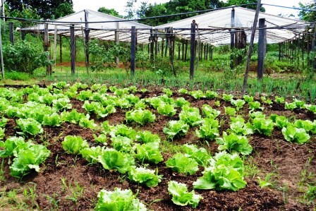
The project was structured into six subprojects, namely: (i) improvement and application of methodologies for detecting deforestation in the Atlantic Forest biome; (ii) improvement and application of methodologies for detecting deforestation in the Caatinga biome; (iii) improvement and application of methodologies for detecting deforestation in the Pampa biome; (iv) improvement and application of methodologies for detecting deforestation in the Pantanal biome; (v) support for the improvement and application of methodologies for detecting deforestation; and (vi) development of a platform for the analysis and visualization of large volumes of geospatial data.
The first four subprojects refer to equivalent activities implemented in different biomes, generating specific results for each. The activities carried out under these subprojects were divided into the following items: (i) construction of a historical series of deforestation maps (maps for the years 2000 (baseline map), 2004, 2006, 2008, 2010, 2011, 2013, 2014, 2016, 2017, 2018, 2019, 2020 and 2021); (ii) calculation of CO₂ emissions and preparation of the National Forest Reference Emission Level (FREL); and (iii) annual monitoring of deforestation for the period 2013–2020.
Products 1 – Construction of the historical series of biennial deforestation maps for the period 2000–2010, and 3 – Annual monitoring of deforestation from 2013 onwards
The construction of the historical series and the annual monitoring of deforestation for the years 2000, 2004, 2006, 2008, 2010, 2011, 2013, 2014, 2016, 2017, 2018, 2019, 2020, 2021 and 2022 for all four biomes has been completed.
In addition, the 2022 deforestation increment map for the Atlantic Forest biome, which was later included in the project, was completed, as well as the development of secondary vegetation maps for the years 2018, 2020 and 2022. For the production of these latter maps, several data‑processing steps were required, including: 1. Merging geometries with the same attribute (dissolve), removing the cell partitioning used only for operational control; 2. Removal of areas smaller than 1 hectare; 3. Topological verification; and 4. Adjustment of attributes for publication.
Throughout the project, for each of the four biomes, the following steps were carried out: (i) construction of a database using TerraAmazon; (ii) production of the reference map of accumulated deforestation for each year (image selection, image processing for interpretation, image interpretation and interpretation auditing); (iii) validation of the deforestation map; and (iv) preparation of a mapping report.
Product 2 – Calculation of CO₂ emissions and preparation of the FREL
After building the historical series of deforestation maps, CO₂ emissions were calculated for the deforested areas in this period, for the purpose of preparing the national FREL. For each of the biomes, the following steps were foreseen: (i) development of a database listing, for each year, the mapped deforestation polygons, the corresponding forest formations and the applied carbon densities; (ii) calculation of carbon values per unit area for different vegetation physiognomies; (iii) construction of the baseline; (iv) validation of the vegetation map; (v) estimation of CO₂ emissions; (vi) workshop to present the results obtained; and (vii) final product report.
The calculation of carbon stock values, the construction of the baseline and the estimation of CO₂ emissions were fully completed for all biomes. The data processed under the project were used to prepare the national FREL proposal. The national FREL proposal was submitted in December 2022 to the United Nations Framework Convention on Climate Change (UNFCCC).
The fifth subproject, transversal to the first four, comprised mainly continuous support activities to the other project actions. It included allocating a team to support the work carried out. The team consisted of information technology professionals responsible for activities such as: (i) adaptive maintenance of the TerraAmazon software; (ii) maintenance and administration of the computational infrastructure used by the project; and (iii) analysis and processing of data produced by the satellite image interpretation team, including activities such as running algorithms to merge polygons, removing inconsistencies, and consolidating data and information.
The sixth subproject, in turn, aimed to develop a technological solution named “Brazil Data Cube”, whose main objective is to organize, store, access, process and analyze large volumes of Earth‑observation satellite images modeled as multidimensional data cubes. Through this platform, analyses are carried out based on medium‑resolution remote sensing images (20 to 30 meters) from the Landsat, CBERS and Sentinel satellites for the entire Brazilian territory, producing land‑use and land‑cover information and satellite‑image time series.
All activities planned for Subproject 6 have been completed. All data are available on the web portal for visualization, access, analysis and download. The preprocessing scripts, cube‑generation scripts, access and processing services are available both on INPE’s infrastructure and on the project’s GitHub repository. It was also possible to update the remote‑sensing data cubes for all biomes up to September 30, 2023.
From the Brazil Data Cube platform, six land‑cover change classification maps were created, one for each biome.
The creation of a version 2.0 of the Data Cube containing all applications developed during the project, as well as improvements and updated versions, was also foreseen. Another approved action during the project was the creation of a video for the Atlantic Forest, Pampa and Pantanal biomes, containing information and specific characteristics of each ecosystem.
At the end of the project, all actions were fully executed (100%).
The maps for all the years initially planned for execution were completed for the four biomes, and additional outputs included the 2022 mapping, secondary vegetation maps and the Data Cube update up to September 2023.
Since the beginning of the project, 51 articles have been published in journals and conferences. The decision was made to publish in journals with Open Access policies, to ensure wide dissemination among both researchers and the general public.
In total, 29 training and capacity‑building events have been conducted, reaching more than 1,800 participants, including 28 national and 1 international event. The Brazil Data Cube team also participated in 47 events (32 international and 15 national) and registered four software systems.