Versão em Português
Project

Amazon's Water Springs

Municipality of Alta Floresta, in the state of Mato Grosso

Project official website
Total project value
R$ 2,781,340.40
Total support amount
US$ 1,554,863.82
Concluded

Presentation

Objective

To provide support to strengthen municipal environmental management by conducting environmental diagnosis making is feasible to register small rural properties in the Rural Environmental Registration (CAR), besides fostering efforts to recover degraded permanent preservation areas close to springs located on the small properties

Beneficiary

Local population, especially rural producers

Territorial scope

Municipality of Alta Floresta, in the state of Mato Grosso

Description

CONTEXTUALIZATION

The municipality of Alta Floresta is located in the extreme north of the state of Mato Grosso, in an area suffering from extreme deforestation. In 2008, the Ministry of the Environment included the city on the list of priority municipalities for efforts to monitor and control deforestation.

Income in Alta Floresta is influenced by the predominant economic activities, which include cattle-raising and timber exploration. As a result of the occupation of the municipality’s territory and the economic activities developed there, there has been environmental degradation. In 2012, the deforested area in the municipality of Alta Floresta accounted for 54% of its total area. According to data from the Municipal Secretariat of the Environment in Alta Floresta, of the nearly 8,000 springs that exist in the municipality, only 4,000 were preserved I 2010. 

THE PROJECT

The project Olhos d’Água in the Amazon includes a series of efforts to tackle the rural environmental degradation problem in Alta Floresta, especially the springs located on small properties, preventing water shortage problems in the city.

Among the activities implemented by the project was support to help small rural producers to adhere to the Rural Environmental Registration (CAR), an environmental management instrument that, through geo-processing, enables the delimitation of rural properties, identifying permanent preservation areas and legal reserves, for environmental recovery and monitoring.

The project also provides support to design technical projects to recover permanent preservation areas on rural property and to make it feasible to recover springs on small properties, as well as implementing demonstrative projects showing agroforestry systems with seed and sapling planting, as well as plants with ecological grazing management in 20 rural properties in Alta Floresta.

Besides having contributed to removing Alta Floresta from the list of municipalities that deforest more in the Amazon and to the recovery of degraded areas, the project Olhos d’Água in the Amazon also supplied municipal administration instruments to improve and provide efforts aimed at monitoring and controlling deforestation.

INTERVENTION LOGIC

This project falls under the “Sustainable Production” and "Monitoring and Control" component of the logical framework of the Amazon Fund.

Click on the following image to view its objectives tree, that is, how the project's outputs and linked to the expected outcomes and impact.
quadrologico_EN

Evolution

Date of approval 08.17.2010
Date of the contract 01.25.2011
Date of conclusion 12.31.2013
Disbursement period 36 months (from the date the contract was signed)
approval
08.17.2010
award
01.25.2011
conclusion
12.31.2013

Disbursement

date amount
1º disbursements 03.23.2011 R$402,082.30
2º disbursements 07.15.2011 R$1,207,952.69
3º disbursements 12.15.2011 R$741,853.95
4º disbursements 07.23.2012 R$346,788.12
5º disbursements 01.23.2013 R$44,133.60
6º disbursements 11.27.2013 R$38,529.74
Total amount disbursed R$2,781,340.40

Total amount disbursed in relation to the Amazon Fund’s support

100%

ACTIVITIES CONDUCTED

Following are the main activities developed within the scope of the project Olhos d’Água in the Amazon:

  1. A technical team was trained, emphasizing georeferencing, CAR, implementing agroforestry systems to recover degraded areas, grazing rotation and environmental monitoring

  2. Rural producers were mobilized to environmentally regularize their properties, by adhering to the CAR, and to obtain the rural property certificate issued by INCRA

  3. Support was provided to implement the CAR in Alta Floresta. Requests to enroll were registered for 2,801 properties at the Mato Grosso State Secretariat of the Environment (SEMA-MT), covering an area of 159,028 hectares

  4. Geodesic georeferencing was carried out on 1,220 rural properties aimed at obtaining the rural property certificate issued by INCRA, covering an area of 46,858 hectares

  5. Some 1,738 hectares of degraded permanent preservation areas (riverbank growth) were reforested, by distributing material to rural producers, including wire, bark chips, seeds and saplings, to isolate planting areas. Of this total, some 101 hectares were implemented through agroforestry systems, which mix tree species with farming. Also, close to springs were fenced off for recovery.

  6. Degraded areas undergoing recovery and natural regeneration close to springs and along riverbanks were monitored, as was deforestation and burn-offs in 100% of the Alta Floresta municipal area

  7. Some 20 demonstrative grazing rotation examples and agroforestry systems were implemented, with 80 hectares of pasture recovered

  8. A geographical databank was built at the Municipal Secretariat of the Environment in Alta Floresta, using data from the properties enrolled in the CAR and satellite images with important information on rural properties

  9. The seminar Recovery of Degraded and Deforested Areas and Grazing Rotation on the Portal of the Amazon was held, focusing on aligning concepts and practices in issues such as recovery of degraded areas and grazing rotation for dairy and beef cattle-raising activities. Also, the seminar Strategies and Projects for a Green Municipality in the Amazon was held, which included an assessment of the impacts achieved in the first year of the project Olhos d’Água in the Amazon.

Final Evaluation

INSTITUTIONAL AND ADMINISTRATIVE ASPECTS

The project Olhos d’Água in the Amazon, among others, had the following partners: the State University of Mato Grosso (UNEMAT), the Life Center institute (ICV), the Ouro Verde institute (IOV), the Avina Foundation, INCRA, the Brazilian Farming and Cattle-raising Research Company (EMBRAPA), SEMA-MT, the Municipal Secretariat of Agriculture in Alta Floresta and the Alta Floresta Rural Union.

In the scientific field, UNEMAT was key to collecting botanic data. In the technical area, the ICV, the IOV, the Avina Foundation, INCRA, SEMA-MT and Embrapa contributed with know-how in their respective areas. Embrapa also made available it technical team for specialized technical follow-up.

INCRA signed a term of commitment to speed up the analysis of rural georeferencing processes sent to obtain the rural property certificate that it issues. In its turn, together with SEMA-MT a partnership was established to effectively carry out environmental regularization of the municipal territory through adherence to the CAR.

INDICATORS FOR RESULTS AND IMPACTS

Main indicators for the project:

  • Number of properties that managed to protocol their request for CAR at SEMA-MT

Some 2,801 rural property requests for CAR were protocolled, meaning some 82% of the Alta Floresta municipal area was registered.

The municipality of Alta Floresta, in 2008, was included on the list of priority municipalities for efforts to prevent and control deforestation in the Amazon, which gave rise to restrictions on rural producers in this city, even in terms of credit. The municipality was included on this list due to the total area that had been deforested and the increasing rate of deforestation.

To be removed from the list of municipalities that deforest most in the Amazon and to be seen as having deforestation monitored and under control, the municipality had to meet several criteria. One was that 80% of its territory (excluding public Conservation Units and registered indigenous land) containing rural properties would be monitored by the CAR.

Once implemented, the project managed to meet this and other criteria so that Alta Floresta could be removed from the list of the cities that most deforest, which occurred in 2012 by means of the Ministerial Order Nº. 187 issued by the Ministry of the Environment.

  • Reforested areas

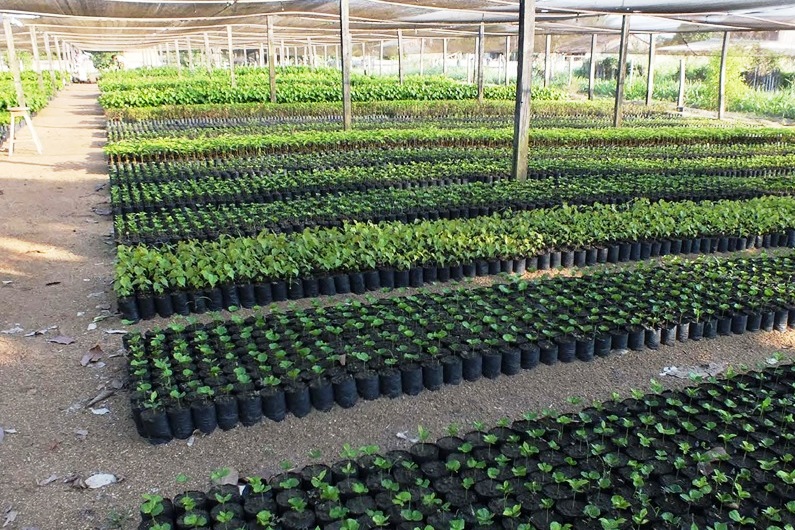
The project’s goal was to recover 1,200 hectares. The project is in the process of recovering 1,738 hectares.

  • Number of demonstrative units implemented

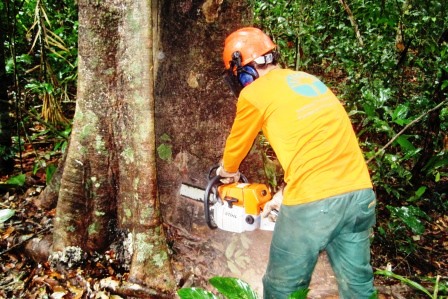
Some 20 demonstrative units were implemented in four sectors of the municipality of Alta Floresta, with grazing rotation activities totaling 80 hectares and the recovery of 101 hectares of degraded areas through the use of agroforestry systems. On the 20 properties that benefited directly from the project, the rate of animal per hectare improved, going from one to three head of cattle per hectare, an increase of 300%.

  • Number of families and people benefiting

Some 10,992 people (2,748 families) benefited directly, of which 6,705 were men (61%) and 4,287, women (39%).

Another monitored indicator is the annual deforestation rate in the municipality of Alta Floresta, measured by the National Institute for Space Research (INPE) (Following table).

  • Annual Deforestation Rate in the Alta Floresta Municipality 

Year

Annual deforestation in km2

2002

132.6 

2003

126.2

2004

230.9

2005

124.9

2006

97.1

2007

61.4

2008

15.3

2009

7.2

2010

3.0

2011

5.8

2012

1.6

The table above shows a substantial drop in deforestation since 2006, as a result of public policies aimed at combating deforestation which were implemented as of 2004. In the year immediately preceding the support from the Amazon Fund, that is, in 2010, annual deforestation in the municipality of Alta Floresta was 3 km2. In 2012, deforestation measured by INPE was 1.6 km2, that is, there was a fall in deforestation over this period.

Other indicators used by the project:

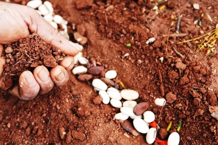
  • Number of producers trained to implement agroforestry systems: 1,720

  • Number of rural properties benefiting from the recovery of deforested areas through the use of agroforestry systems, conventional planting and/or natural regeneration: 1,314

  • Number of calls attended from rural producers requesting technical assistance: 5,600

  • Number of staff members of the Municipal Secretariat of the Environment that were trained in monitoring based on geo-processing techniques: 17

  • Number of properties that were mapped out using georeferencing and that are now ready to register on the CAR: 3,361

  • Number of property perimeters that were mapped out using georeferencing to obtain the rural property certificate issued by INCRA: 1,220

SUSTAINABILITY OF RESULTS

The project Olhos d’Água in the Amazon was key in removing the municipality of Alta Floresta from the list of cities that deforest most in the Amazon. The federal government established that municipalities removed from this list would be classified as having deforestation monitored and under control. In these cities, allocating economic and fiscal incentives should prioritize plans, programs and projects aimed at fostering sustainable economic and social development.

Seeking to continue and expand the results of the project Olhos d’Água in the Amazon, on May 9, 2013, the municipality of Alta Floresta was awarded further support from the Amazon Fund, under the project Olhos d’Água in the Amazon – Phase II, which aims to recover degraded areas, implement environmental regularization of rural properties with family farming, increase INCRA’s certification of rural properties, and support the development of sustainable production development.

To access the effectiveness evaluation report of the "Amazon Water Springs" project click here. This assessment was carried out by a team of independent consultants, under the coordination of the Deutsche Gesellschaft für Internationale Zusammenarbeit - GIZ. All opinions expressed are the sole responsibility of the authors, not necessarily reflecting the position of GIZ and BNDES.


Collection

In this area we offer some PDF files with the main publications generated by the project. Click the filename to start the download.